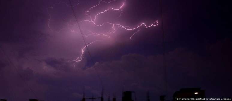
Europa is putting a new generation of weather satellites into orbit, which should track changes in the atmosphere more accurately. Air traffic is a potential beneficiary of the new data: what will the weather be like tomorrow? This question is almost as frequent as the one that often arises the next day: Why, after all, was the prediction wrong? Indeed, weather forecasts can cause heated arguments, especially when they are wrong.
What few people know is that weather forecasting “is a hugely underrated scientific achievement,” said Phil Evans, director general of the European Organization for the Exploration of Meteorological Satellites (EUMETSAT), a European meteorological satellite agency that monitors the weather. and climate from space.
According to Evans, weather forecasting is a “chaotic system, as the smallest change can have a big impact on what happens over the next three, four or five days.” The calculations include parameters such as humidity, temperature, sea surface temperature and winds. All of this data comes from weather balloons, aircraft and ships, measuring buoys, weather radar stations, weather stations, automatic earth stations, and satellites.
The latter, says Evans, fill a specific gap, as they provide data related to areas that are difficult to access, such as deserts, primeval forests or ocean surfaces, thus allowing almost complete monitoring. Since 1977, Europe has had its own geostationary meteorological satellites called Meteosats, which monitor the Earth from a height of around 36,000 kilometres.
Difficulty predicting extreme weather conditions
Current weather models often predict the weather up to 14 days ahead. The most realistic, however, is a maximum of ten days, Evans points out, with accuracy increasing with each additional day. The 24-hour forecast, for example, has a probability of being correct around 90%, while the three-day forecast achieves an accuracy of just over 75%.
But when it comes to extreme weather events, the forecast varies depending on the type of weather event. Major events, such as those caused by a tropical hurricane, for example, can be predicted with a high degree of probability several days in advance.
In the case of extreme weather events in a smaller area, such as tornadoes in the US or severe storms in Europe, prediction is nearly impossible, although they can also cause a lot of damage. “Many times, storms can only be predicted six to twelve hours in advance,” says Evans. Here, so-called nowcasting (“forecasts in real time”) is often used, in which satellite data plays a key role.
A new generation of satellites
That’s why a new group of satellites has caused a lot of excitement among meteorologists: the third generation Meteosat satellites (MTG 3rd Generation), which are expected to replace their predecessors in the coming years. In total, six new MTG satellites will be in orbit, with the first of them, MTG-I1, starting its mission on December 13, 2022.
With the new MTGs, it will be possible to monitor changes in the atmosphere, land surfaces and oceans even more precisely. With your data, the entire life cycle of a storm must be monitored for the first time. This is, incidentally, one of the focal points of MTG’s mission: to improve the prediction of storms and thunderstorms.
New satellite data can also recognize storm clouds more clearly and better estimate their duration. Furthermore, the predictions should be able to be limited to a smaller area.
One potential beneficiary of the new system will be air traffic, where severe thunderstorms are often a risk. With the help of satellite data, pilots will have the opportunity to go around the storm at an early stage. This is especially important in the area covering the Atlantic, where airflow is high, Evans explains.
The first images released by the lightning detector
On board the MTG-I1 is the Lightning Imager (LI), the first tool for continuously monitoring lightning activity. In early June, EUMETSAT commissioned LI, which is equipped with four telescopes aimed primarily at Europe, North Africa, the Middle East and South America. Each of them records 1,000 images per second.
They must therefore detect electrostatic discharges directly from space, day or night and in any environment, be it sea, city or desert. Even a single beam that is virtually imperceptible to the naked eye can be detected.
The first images of LI were released this week. However, the MTG-I1 is currently in the commissioning phase, meaning the instruments are being calibrated and the data validated. Starting in 2024, Lightning Imager data will be fully utilized.
Prediction of extreme events more and more accurate
By next year at the latest, weather services will be able to use the data for their daily forecasts. “Before severe thunderstorms, there are often abrupt changes in lightning activity,” explains Phil Evans. “By monitoring this change in activity, LI can help meteorologists predict large storms.” Furthermore, the data is processed by special algorithms so that only relevant information is transmitted to the Earth.
‘Storm warnings and short-term forecasts will improve significantly,’ promises the Director General of EUMETSAT, for whom the new era of satellite technology will help save lives.
Source: Terra
Rose James is a Gossipify movie and series reviewer known for her in-depth analysis and unique perspective on the latest releases. With a background in film studies, she provides engaging and informative reviews, and keeps readers up to date with industry trends and emerging talents.


