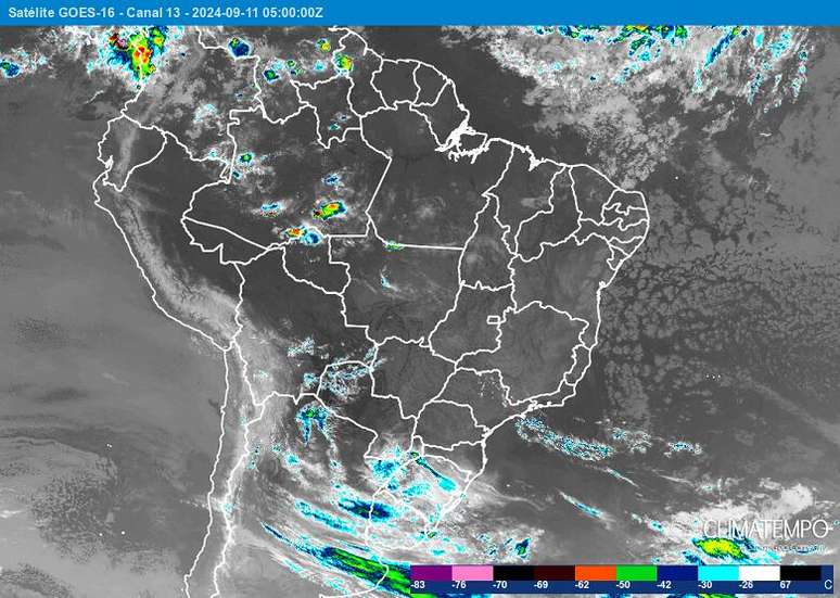
Check the weather forecast for all of Brazil for this Wednesday, September 11.
A new cold front arrives in Rio Grande do Sul during the day, increasing conditions for winds in the state and rain at night in western and southern Rio Grande do Sul.
The winds gain a little more intensity due to the atmospheric circulation throughout the interior of the country, including the interior of the SP, which can favor the spread of fires.
Maritime circulation in the Northeast, still stimulating some rain clouds on the southern coast of Bahia and between Maceió and João Pessoa. Strong gusts of wind on the northern coast of the Region.
Isolated rain showers in the morning in the central-north. In the afternoon, the heaviest precipitation occurs in the northwest of the state.
Drought and intense heat continue in central Brazil
Attention: possibility of occurrence rain with soot (black rain) in Brazil in the next few days
Few clouds, dry air, smoke and very hot this Wednesday in Brazil. 9/11/24
Weather forecast for Wednesday – 11/24/24
Southern Region
A new cold front arrives in southern Brazil and brings winds. Rainfall will increase in the west, in Campanha Gaúcha and in the extreme south of RS, especially in the afternoon and at night, and will last until the early hours of Thursday. The southern region will be in pre-frontal conditions and Porto Alegre could have a peak of heat with a maximum expected of 36°C before the arrival of the cold wind. Air humidity decreases in the north and northeast of RS, in the west and north of SC and much of PR continues with a very dry climate, with no rain forecast.
In the north/northwest of PR temperatures up to 40°C can occur
South-East Region
On Wednesday, beware of gusts of wind in the Southeast. In the interior of SP, this condition favors the spread of fires. The greatest gusts occur towards the coast and south of RJ.
No rain is forecast for any area of the southeastern region. Air humidity remains low and air quality is compromised. Inland SP and Triângulo Mineiro, humidity levels close to 10% can occur.
Heat near 40°C in the west and north of SP and MG
Midwest Region
The action of low atmospheric pressure over Paraguay and the movement of a cold front in southern Brazil increase winds in the Center-West. In Corumbá and the western part of MS, strong gusts of close to 70 km/h can occur, which can cause the spread of fires.
The entire Midwest has another very dry day, with a lot of smoke in the air, which hides the blue skies and sunshine and worsens the air quality. No rain is forecast.
Air humidity levels in the emergency range, below 12% in MS, MT and GO, including the capitals Cuiabá, Campo Grande and Goiânia.
Heat of 40°C or more occurs again in MS, MT and GO.
North-East Region
The humid winds that blow from the sea against the eastern coast of the Northeast favor the formation of many clouds, which can cause moderate rain in several places in the region. The showers alternate with several periods of sunshine.
Winds remain strong, but no rain on the northern coast of the Northeast. Stronger gusts on the coasts of PI, CE and RN.
Humidity remains on alert in most of the inland areas of the Northeast, where there are no conditions for rain.
Possibility of heat of 40°C in the central-southern MA, PI and western BA
Northern Region
In the north of the country, the climate is dry and very hot, with a lot of smoke in the air. Rain occurs in the form of irregular showers, in the afternoon and evening, and at night, in the northwest in the morning.
Air humidity remains very low and reaches levels below 20% in TO, southern and eastern PA and central-southern RO.
In TO and PA, heating up to 40°C is possible.
Source: Terra
Rose James is a Gossipify movie and series reviewer known for her in-depth analysis and unique perspective on the latest releases. With a background in film studies, she provides engaging and informative reviews, and keeps readers up to date with industry trends and emerging talents.


